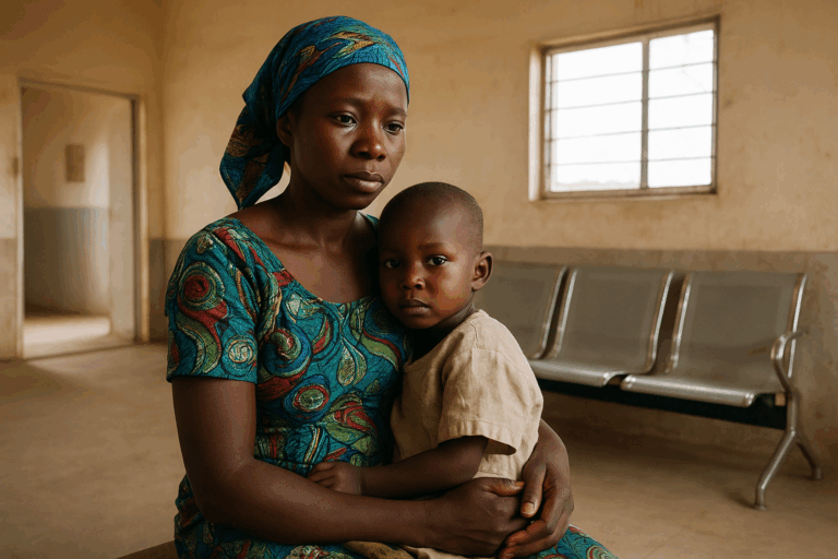
Post-disaster recovery is a multifaceted effort aimed at rebuilding both physical infrastructure and social systems after a catastrophe, whether it’s a flood, earthquake, or hurricane. Such process demands not only immediate action for relief but also long-term strategies to restore communities and livelihoods. A key tool in modern recovery efforts is free high-resolution satellite imagery, which offers a clear, wide-reaching view of affected areas. These images help emergency responders assess damage, prioritize resources, and track the pace of recovery over time. Satellite technology has definitely become indispensable in this domain, offering real-time data that improves decision-making and makes recovery more efficient and informed.
Satellite data & post-disaster management
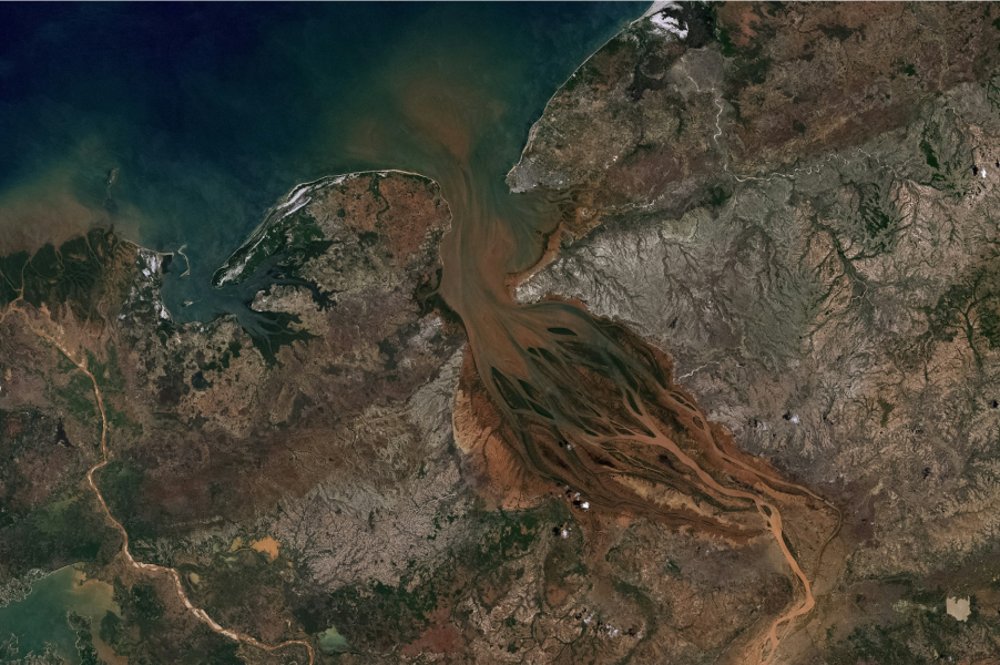
Satellite imagery plays a crucial role in post-disaster management, providing a comprehensive and timely view of affected areas. When a natural disaster strikes, conditions on the ground are often chaotic, making it difficult to assess the full extent of the damage. This is where the ability to download real-time high-resolution satellite imagery becomes invaluable. With just a few clicks, responders can access detailed visuals from space, offering critical insights into the hardest-hit areas, enabling faster, more effective relief efforts.
One of the primary applications of satellite imagery in post-disaster management is damage assessment. After a disaster, ground-based inspections may be slow or impossible due to unsafe conditions. Satellite images, however, provide an overhead view, enabling authorities to see which areas have been most impacted. This information helps prioritize rescue missions, allocate resources, and identify where infrastructure — such as roads, bridges, or hospitals — has been compromised.
Another key area is disaster mapping and response planning. High-res satellite images allow for the creation of detailed maps that guide emergency teams through affected regions, showing accessible routes and the locations of key facilities. These maps are particularly useful when disaster causes large-scale displacement or alters the landscape, such as in floods or landslides.
In the longer term, monitoring recovery progress is another vital use of satellite data. As communities rebuild, satellite images can track changes in the landscape, vegetation, and infrastructure. This helps governments and NGOs ensure that rebuilding efforts are on track and that the most vulnerable areas are receiving the necessary support.
Additionally, satellites can support environmental monitoring after a disaster. In cases like wildfires or oil spills, satellite images can track environmental damage, enabling a quicker and more accurate response to mitigate long-term ecological harm.
Response and recovery phases of disaster management
Disaster management is structured around four main phases: mitigation, preparedness, response, and recovery. The first two stages aim to lessen the possible effects of disasters and ensure that communities are well-prepared when they occur. This involves strategic planning, public education, and enhancing infrastructure to reduce potential harm.
The critical action, however, happens during the response and recovery phases. Right after a disaster strikes, the response phase comes into play, where emergency teams spring into action. Their efforts focus on rescuing individuals, providing medical support, and ensuring essentials like food and water are accessible. During this hectic time, satellite technology becomes indispensable. With real-time imagery, satellites give a detailed, wide-scale view of the impacted areas. This information allows emergency crews to prioritize the most urgent needs, determine which roads remain usable, and locate survivors in isolated regions. Essentially, satellites offer a bird’s-eye perspective that guides responders in making swift, informed choices.
As the immediate danger subsides, the focus shifts to the recovery phase. This is where the long-term work begins — rebuilding homes, restoring infrastructure, and helping communities regain a sense of normalcy. High quality satellite images play a pivotal role here as well. By comparing pre- and post-disaster visuals, recovery teams can track the progress of rebuilding efforts, monitor environmental changes, and ensure resources are being directed where they’re most needed. This bird’s-eye perspective helps officials identify which areas remain vulnerable and adjust recovery plans accordingly, ensuring a more resilient future for the affected region.
In both the response and recovery phases, satellite imagery offers critical insights that ground-based efforts simply can’t match, making disaster management more effective and efficient.
Future of satellite images in post-disaster
It’s evident that satellite imagery has quite a promising future in the realm of post-disaster management. As technology evolves, satellites will become even more powerful, delivering high-resolution Earth images at a frequency that will ensure near-instantaneous updates. This real-time data will give emergency responders the ability to make quicker, more informed decisions during the critical hours following a disaster, reducing the time it takes to save lives and provide essential resources.
One exciting development is the increasing use of artificial intelligence (AI) and machine learning to analyze satellite images. These technologies will be able to automatically identify damage patterns, predict the most vulnerable areas, and prioritize rescue efforts without human intervention. This could revolutionize how we understand the aftermath of a disaster, making relief operations faster and more targeted.
Another promising aspect is the growing network of small, low-cost satellites known as CubeSats. These miniature satellites can be deployed in large numbers, providing continuous coverage of the Earth’s surface. This constant stream of data means that no disaster will go unnoticed, and updates will be more frequent, allowing for a more dynamic response.
In the longer term, satellite imagery will likely play a role in disaster prevention as well. With the ability to monitor changes in climate, weather patterns, and environmental stressors, satellites will help predict when and where disasters are most likely to occur. This will enable communities to prepare more effectively, reducing the overall impact of these events.
As satellite technology becomes more advanced and accessible, its role in post-disaster management will only grow. The future promises more precise, faster, and actionable insights from space, making recovery efforts smarter, more efficient, and ultimately, more capable of saving lives.

Kateryna Sergieieva
Kateryna Sergieieva has a Ph.D. in information technologies and 15 years of experience in remote sensing. She is a scientist responsible for developing technologies for satellite monitoring and surface feature change detection. Kateryna is an author of over 60 scientific publications.